By Eric Andrew Kristof, RN, CAHIMS | Healthcare IT Professional | HIMSS Arkansas Chapter Member
About This Series: The HIMSS Word of The Day is a running blog series drawing from the HIMSS Dictionary of Health Information and Technology Terms, Acronyms, and Organizations, 6th Edition (2025) — the authoritative reference for healthcare IT professionals and the primary study resource for CAHIMS and CPHIMS certification. Each post paraphrases the term in plain language, grounds it in real-world healthcare IT context, and adds a bedside nursing perspective you won’t find in a textbook.
📖 The Term: Geographic Information Science (GISci)
Source: HIMSS Dictionary of Health Information and Technology Terms, Acronyms, and Organizations, 6th Edition (2025)
🔍 Plain-Language Definition
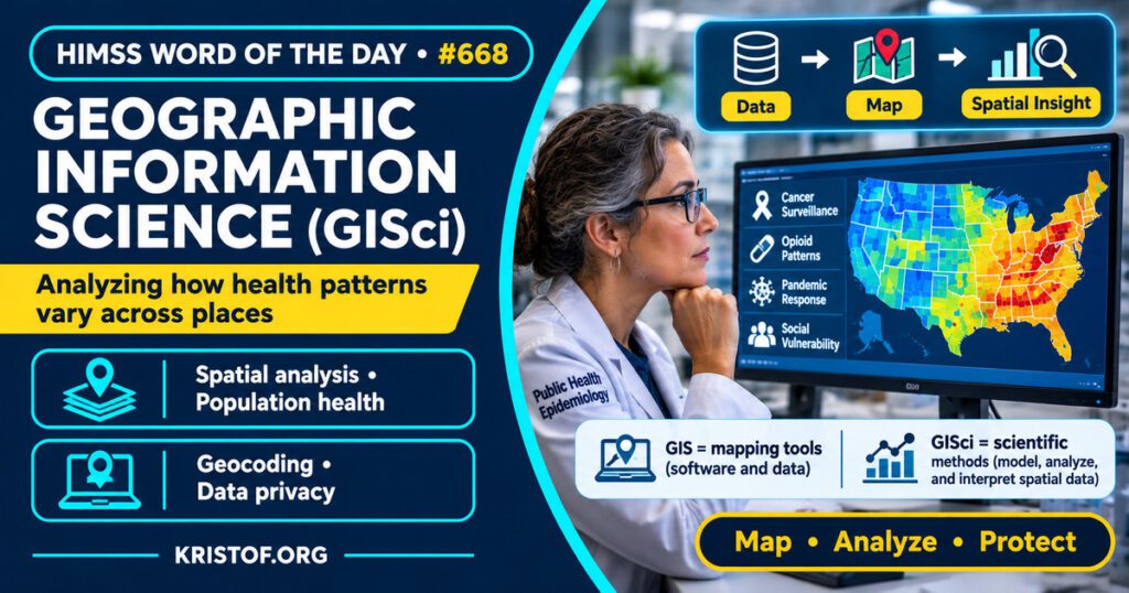
The HIMSS Dictionary describes geographic information science (GISci) as the discipline concerned with studying and handling location-based data, and with applying mathematical and computational tools to convert that data into useful information.
In the health literature, Sahar and colleagues (2019) describe GIScience as the discipline that applies geographic information systems (GIS) and other spatial concepts and methods in research. That helps separate the two: GIS is the software and data systems, while GISci is the field that asks how to represent, analyze, and interpret geographic data.
| Element | What it means | Example from the sources below |
|---|---|---|
| Geographic data | Information tied to a location | Case counts linked to counties or census tracts |
| Representation | How place is modeled in a system | Points, areas, or richer ideas of place |
| Analysis | Methods for finding spatial patterns | Descriptive mapping, spatial regression |
| Application | The health question being asked | Cancer surveillance, overdose patterns, COVID-19 response |
⚠️ Exam Alert: GISci is a field of study, while GIS is a system or software. A question asking which one analyzes and interprets geographic patterns points to GISci, and a question asking which one stores, displays, and maps data points to GIS. Also keep geocoding (turning an address into coordinates) separate from spatial analysis (finding patterns in located data).
🌐 Why It Matters: Real-World Healthcare IT Context
Mapping and surveillance. Sahar and colleagues (2019) review GIScience in cancer research. They note that maps are an effective way to present health data, that data can be linked to features such as counties or census tracts, and that a spatial approach can identify location-based patterns and trends in risk factors, health outcomes, and population health. They describe perspectives that include the individual, the health care infrastructure, and the environment, and suggest GIScience can inform decision-making and policy. That is the reviewers’ view, not a measured effect on cancer outcomes.
Pandemic response. Smith and Mennis (2020) describe six areas where geographic information science and technology contributed to the COVID-19 response: spatial data infrastructures for surveillance and data sharing, mobility data in forecasting, digital contact tracing, integration of geographic data into modeling, study of social vulnerability and disparities, and communication of disease or facility status. They add that the locations and availability of protective equipment, ventilators, and hospital beds can be optimized with these tools. Challenges they name include protecting individual privacy and civil liberties and closer collaboration among geography, medicine, public health, and policy. This is a commentary and overview, not a trial.
What a literature looks like. Sauer and Stewart (2023) conducted a scoping review of GIScience in research on the U.S. opioid overdose crisis, covering publications from January 1999 to August 2021. They found 231 qualifying studies, most published from 2017 onward. The majority (58.4 percent) were at the sub-national level, and 41.6 percent used nationwide data. California, New York, Ohio, and Appalachia were most frequently studied, while the Midwest, north Rocky Mountains, Alaska, and Hawaii lacked studies. Descriptive mapping was the most common method and county-level data the most common unit. They suggest future work could use machine learning, sub-county analysis, and questions about illicit fentanyl. A scoping review describes what has been studied, not whether the interventions worked.
Better spatial models. Buchalter and colleagues (2024) review common spatial models for kidney research and run a case study using national chronic kidney disease surveillance data for 2019 and Environmental Protection Agency environmental quality index data from 2006 to 2010. They report that spatial models improved fit compared with a nonspatial model, and that one local model showed spatial heterogeneity in the relationship between the index and kidney disease prevalence. This is a single illustrative case study of area-level data, so it does not show cause.
The idea of place. Mennis and Yoo (2018) argue that representing place is a key advance GIScience can offer health research, and that useful representations should include subjective, experiential, and relational aspects of place and people’s time-activity patterns, not only fixed locations. This is a conceptual argument without data in the abstract.
Privacy. Brownstein and colleagues (2005) note that maps showing patients as points are often shared in public forums and that even low-resolution maps may reveal confidential locations. They describe a method for testing whether privacy is being breached by reverse geocoding from maps and checking how accurately patient addresses can be extracted. The abstract gives no accuracy figures, and the paper is from 2005, so current tools and practices differ.
What I could not confirm. Most of these sources come from public health and epidemiology research, not from hospital IT operations, so I cannot say how health systems use GISci day to day. I did not find a study showing that geographic analysis improves patient outcomes in routine care. I read abstracts only, and I did not verify how current GIS tools handle location privacy.
Common GISci problems:
- Treating GISci as the same thing as mapping software
- Showing small-area maps that could reveal where patients live
- Using area-level data to draw conclusions about individual patients
- Poor address quality, which weakens geocoding
- Gaps in geographic coverage, as seen in the opioid literature
What supports GISci:
- Clear questions about where and why patterns occur
- Linking data to standard geographic units such as counties or census tracts
- Spatial methods that account for location structure
- Privacy checks before maps or location data are shared
- Collaboration among geographers, clinicians, and public health staff
🏥 The Nurse’s Perspective: Clinical, Bedside, & Workflow
Nurses see the human side of geographic data, since location often shapes health, access, and risk.
At the Bedside
Address and neighborhood details recorded at registration and during assessments become the raw material for geographic analysis later. Mennis and Yoo (2018) argue that place and time-activity patterns matter for health, which is a reminder that a nurse’s questions about home, work, and travel can carry real information. This is a practical observation, not a finding from a nursing study.
In Clinical Workflow
Public health and community nurses often work with surveillance maps and area-level data. Brownstein and colleagues (2005) raise a workflow caution: sharing a map of patient locations can expose confidential details, so a nurse preparing a presentation or report checks with the privacy officer before including any location-level display.
In EHR Implementation (Go-Live Perspective)
During an Epic Go-Live, analysts and at-the-elbow support staff see how address fields are entered. Consistent, complete addresses make later geocoding more reliable. That is a workflow inference, and the studies above do not test address entry.
🎓 CAHIMS / CPHIMS & HIMSS Perspective
CAHIMS Exam Domain Mapping
GISci connects data analysis, public health, and privacy:
| CAHIMS Domain | How GISci Appears |
|---|---|
| Healthcare & Technology Environments | Spatial data, mapping tools, and data infrastructures |
| Clinical Informatics | Social determinants, surveillance, and population health analysis |
| Healthcare Information & Systems Management | Geocoding, data quality, and privacy controls |
| Management & Leadership | Resource planning and policy decisions informed by spatial data |
Key Terms to Know Alongside GISci
- Geographic information system (GIS) — software and data systems for storing, displaying, and analyzing location-based data
- Geocoding — converting an address or place name into geographic coordinates
- Spatial epidemiology — the study of how health outcomes vary across places
- Social determinants of health — the conditions where people live, learn, work, and play that affect health
- Population health — the health outcomes of a group and their distribution within it
- Data visualization — presenting data in graphical form such as a map or chart
HIMSS Organizational Position
HIMSS offers education and research on health information and technology topics through its Resource Center. Members can find related information on the HIMSS Resource Center page.
🧭 More HIMSS Word of The Day Terms
Related terms in the Data and Analytics series:
Browse all Data and Analytics terms or the A–Z glossary.
🔗 Explore Further: External References
- Sahar et al. (2019), Cancer — GIScience and cancer: State of the art and trends for cancer surveillance and epidemiology https://pubmed.ncbi.nlm.nih.gov/31145834/
- Smith and Mennis (2020), Preventing Chronic Disease — Incorporating Geographic Information Science and Technology in Response to the COVID-19 Pandemic https://pubmed.ncbi.nlm.nih.gov/32644920/
- Sauer and Stewart (2023), Social Science and Medicine — Geographic information science and the United States opioid overdose crisis: A scoping review of methods, scales, and application areas https://pubmed.ncbi.nlm.nih.gov/36493502/
- Buchalter et al. (2024), Kidney International Reports — Geospatial Modeling Methods in Epidemiological Kidney Research: An Overview and Practical Example https://pubmed.ncbi.nlm.nih.gov/38765574/
- Mennis and Yoo (2018), Transactions in GIS — Geographic Information Science and the Analysis of Place and Health https://pubmed.ncbi.nlm.nih.gov/30479558/
- Brownstein et al. (2005), AMIA Annual Symposium Proceedings — Reverse geocoding: concerns about patient confidentiality in the display of geospatial health data https://pubmed.ncbi.nlm.nih.gov/16779192/
- HIMSS — Resource Center https://www.himss.org/resource-center
Term source: HIMSS Dictionary of Health Information and Technology Terms, Acronyms, and Organizations, 6th Edition (2025). All definitions in this series are paraphrased for editorial purposes. Readers are encouraged to consult the primary source for exact language.
Eric Andrew Kristof, RN, CAHIMS is a Healthcare IT professional and HIMSS Arkansas Chapter member based in Hot Springs Village, AR, with hands-on Epic Go-Live experience and a diverse healthcare and IT background. He writes at kristof.org at the intersection of clinical care and healthcare technology.
Leave a Reply